
Shuswap Lake Level Update 2022
The Shuswap Emergency Program has activated its Emergency Operations Centre to assist with flood preparations in the Shuswap, as both river and lake levels are increasing.
As part of this, the Shuswap Emergency Program will be posting a lake level daily during the flood watch period. Please use this information as a guide to help you make decisions about what flooding precautions are needed to protect your property.
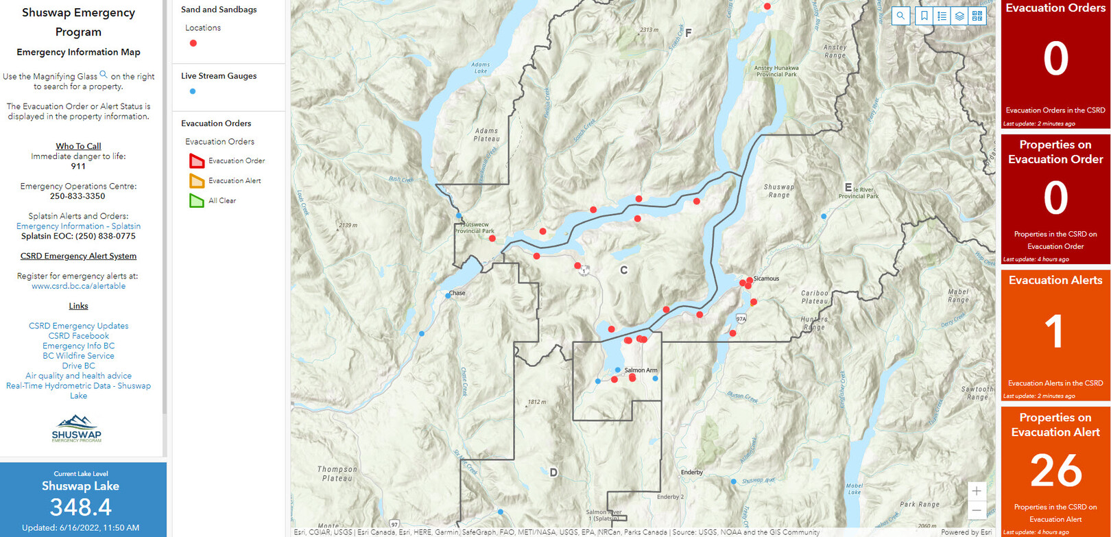
Shuswap Emergency Mapping Dashboard
The Shuswap Emergency Program has updated and enhanced its Emergency Mapping Dashboard, which is a useful tool for residents to stay informed during the Flood Watch. The dashboard now includes include real-time tracking of area lakes and river levels, as well as sand and sandbagging locations. It also provides evacuation alert and order information, if needed. Clicking on the mapped blue dots will bring up information about the live streamed water gauge readings, while the red dots indicate sand and sandbag sites.
Sandbag Pick-Up Locations
Sand and/or bags are being made available at 22 locations in the Shuswap area. Property owners are responsible for taking steps and having the necessary equipment to protect their properties from flooding. Residents are reminded that to be most effective, sandbags should be placed on high ground, as close as possible to homes or buildings.